CHESAPEAKE BAY HAND DRAWN MAP 18 X 24 UNFRAMED
CHESAPEAKE BAY HAND DRAWN MAP 18 X 24 UNFRAMED
Regular price
$ 30.00 USD
Regular price
Sale price
$ 30.00 USD
Unit price
per
Couldn't load pickup availability
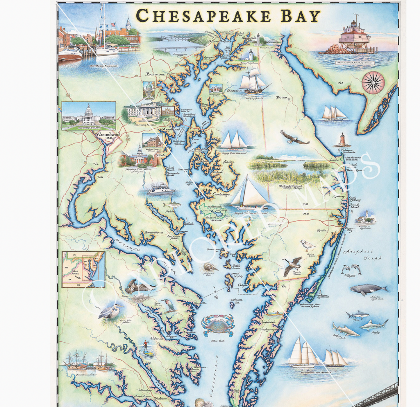
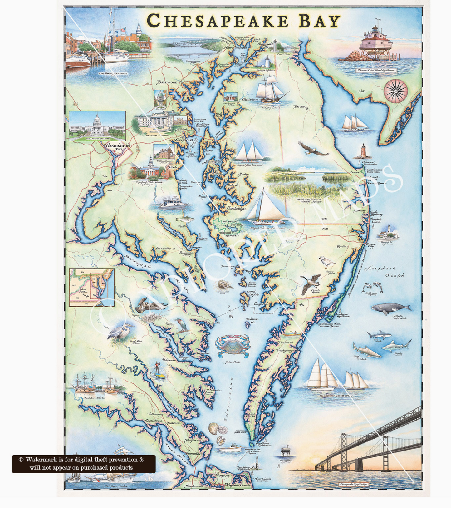
The Chesapeake Bay is the largest estuary (where salt and fresh water mix) in the United States (and 3rd largest in the world!) with 150 rivers flowing into its’ drainage system; covering parts of six states (MD, VA, DE, PA, NY, and WV). The word Chesapeake is an Algonquian word referring to a village “at a big river” and collectively, the Powhatan tribes were the dominant group long before any Europeans arrived in the area. The Bay is home to more than 3,600 species of animals and plants and provides important habitat for wildlife as well as providing an abundance of recreational opportunities. In addition to its famous Blue Crabs and sailing culture, the Bay is also renowned for dozens of shipwrecks and its’ role in The Civil War where the first ironclads battled near Hampton Roads, VA.
Materials
Materials
Shipping & Returns
Shipping & Returns
Dimensions
Dimensions
Care Instructions
Care Instructions